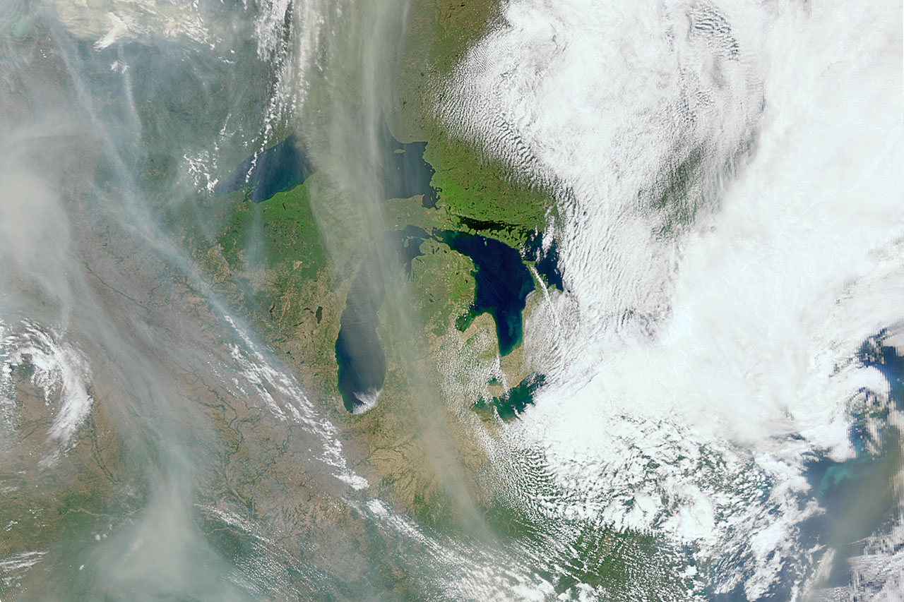
NASA PACE mission tracks wildfire smoke and vegetation risk
The PACE satellite is leveraging unexpected land-observation capabilities to identify fire-risk areas and monitor the atmospheric drift of smoke plumes.
NASA PACE mission tracks wildfire smoke and vegetation risk
NASA is utilizing the Plankton, Aerosol, Cloud, and ocean Ecosystem (PACE) satellite to monitor vegetation precursors to wildfires and the movement of smoke plumes. Although the satellite launched in February 2024 with a primary design focused on Earth’s atmosphere and oceans, it possesses an unexpected capability to observe land surfaces.
The mission uses three specific instruments to gather data on wildfires. The Ocean Color Instrument is a hyperspectral tool that observes the planet across several hundred wavelengths of ultraviolet, visible, and near infrared light. This allows scientists to analyze the health of plants by measuring dryness, stress, and relative pigment balance. According to NASA, this information helps identify high fire-risk areas, which land managers can then use to distribute resources for risk mitigation.
Because the Ocean Color Instrument views the entire Earth daily — with more frequent coverage at high latitudes — scientists can quickly determine the span and location of burn scars on clear days. Skye Caplan, terrestrial lead for the PACE mission at NASA Goddard, stated that identifying these charred areas is important because land burned by wildfire often faces an increased risk of landslides and floods.
The satellite also tracks the aftermath of fires using ultraviolet wavelengths to monitor smoke and determine how high these particles drift in the atmosphere. This altitude data is critical because it influences how far particles travel and which systems they impact. This capability adds to existing fire observations provided by the Moderate Resolution Imaging Spectroradiometer and the Visible Infrared Imaging Radiometer Suite.
Two other instruments, the Spectro-polarimeter for Planetary Exploration one and the Hyper-Angle Rainbow Polarimeter 2, provide data on aerosol composition. Andrew Sayer, PACE project science lead for atmospheres from the Ocean Color Instrument at NASA Goddard, said these tools are rich with information about aerosols from different regions.
By measuring how light reflects off atmospheric particles, these instruments determine the size, shape, color, and chemical properties of the particles, as well as their quantity. This allows scientists to distinguish smoke from other aerosols like dust or pollutants. Smoke particulates are generally small and light-absorbing, appearing brown, black, or gray.
The goal of collecting this data is to improve Earth models.
"The challenge that we have is to take those clues and use them in a meaningful way, so our models of Earth properly represent what’s happening,"
Kirk Knobelspiesse, remote sensing scientist at NASA’s Goddard Space Flight Center, via science.nasa.gov
Knobelspiesse, who also serves as the satellite’s polarimeter lead, noted that the data will help simulate future events and create more accurate wildfire models. This will allow researchers to examine future emission scenarios and understand how smoke from one location impacts other parts of the Earth system.
Beyond wildfires, the PACE mission is designed to provide global observations that benefit air quality, human health, ecological forecasting, and water resources. The satellite's technology is being used to understand the exchange of carbon dioxide between the atmosphere and ocean, as well as how aerosols may fuel the growth of phytoplankton. In the ocean, PACE identifies the diversity of phytoplankton species to help predict marine hazards and the "boom-bust" of fisheries.
The satellite operates in a sun-synchronous orbit 676 km (420 mi) above the Earth's surface. It travels at approximately 451 km per minute (280 mi per minute) and takes about 98.3 minutes to complete a single orbit, covering 44,321 km (27,540 mi) per rotation. This specific orbit ensures the angle of sunlight remains relatively constant, which is necessary for scientists to assess climate change.
PACE is currently engaging with research and applications communities. Teams are collecting data worldwide to validate observations, and 10 products have been made available through NASA’s Earthdata GIS (EGIS) imagery services.