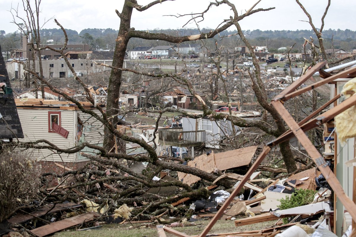
A severe weather outbreak is unfolding across the U.S. Plains and Midwest today, with the National Weather Service warning of strong to intense tornadoes (EF2/EF3+), large hail, damaging winds, and flooding rainfall. Forecasters expect the threat to persist through Tuesday, May 19, 2026, though tornado risks are lower than Monday’s peak.
Storm Tracker: Radar, Warnings, and Real-Time Updates
As of Tuesday morning, severe thunderstorms are spreading from the Southern Plains to the Great Lakes, with localized outbreaks possible across Texas, Oklahoma, Missouri, and Illinois. The National Weather Service’s Fort Worth/Dallas office reports warm, windy conditions today, though isolated storms may develop northwest of the Metroplex later in the evening.
- Current Radar: Live updates on storm movement and intensity via the National Weather Service and commercial platforms like Yahoo Weather.
- Storm Reports: Confirmed reports of tornadoes, hail, and wind damage, compiled in real time.
- Flooding Rain: Interactive maps showing rainfall accumulation and flood risks, particularly in low-lying areas.
- Instability (CAPE) and Wind Shear: Atmospheric metrics critical for severe storm development, with high CAPE values increasing thunderstorm potential.
Caitlin Kaiser, a digital meteorologist with weather.com, notes that while tornado risks have decreased from Monday’s outbreak, the threat of damaging winds and large hail remains elevated. Residents in high-risk zones are advised to monitor local alerts and prepare for rapid weather shifts.
—
Forecast Breakdown: What to Expect Today
Tornado Threat: Lower but Still Present
Monday’s severe weather outbreak brought EF2/EF3+ tornadoes to parts of the Plains and Midwest, but today’s tornado risk is reduced. However, the Storm Prediction Center (SPC) continues to monitor areas for isolated tornadoes, particularly where wind shear and instability overlap. The SPC’s latest advisories emphasize vigilance in Oklahoma, Kansas, and Missouri.
.PNG "Tornado Outbreak Map Tracker National Weather Service")
Hail and Wind: Primary Hazards
Large hail (up to baseball-sized) and damaging winds (exceeding 60 mph) are the most immediate threats today. The National Weather Service warns that these hazards can occur with little warning, even in areas not under a tornado watch. Hailstorms are most likely in Nebraska, Iowa, and southern Minnesota.
Flooding Concerns
Heavy rainfall is saturating soils across the Midwest, raising the risk of flash flooding. The Weather Service advises residents near rivers and creeks to stay informed about localized flood watches. In Texas, where Monday’s storms dumped excessive rainfall, flood advisories remain in effect for parts of the Hill Country.
—
Safety Measures: What Authorities Recommend
- Have a Plan: Know your community’s tornado shelter locations and evacuation routes.
- Monitor Alerts: Use NOAA Weather Radio, wireless emergency alerts, or trusted weather apps for real-time updates.
- Secure Outdoor Items: High winds can turn patio furniture, tools, and debris into projectiles.
- Prepare an Emergency Kit: Include water, non-perishable food, medications, and flashlights with extra batteries.
For those in mobile homes or vehicles, authorities stress the importance of seeking sturdier shelter immediately when severe weather warnings are issued.
—
What’s Next: Outlook for Wednesday and Beyond
While today’s severe weather activity is expected to taper off by evening, meteorologists caution that residual moisture and instability could fuel additional storms Wednesday. The SPC’s extended forecast suggests a lower risk of widespread severe weather, but isolated thunderstorms may still develop across the Upper Midwest.
Longer-term, climate models indicate a pattern shift toward cooler, drier conditions by late week, reducing the likelihood of further severe outbreaks. However, residents in the Plains and Midwest should remain prepared for sudden changes in the forecast.
—
Key Resources for Tracking the Storm
- National Weather Service: Fort Worth/Dallas and regional offices for localized alerts.
- Storm Prediction Center: NOAA’s SPC for national severe weather outlooks.
- Commercial Trackers: Yahoo Weather and The Weather Channel for radar and storm reports.
Residents in high-risk areas are encouraged to bookmark these resources and enable mobile alerts to stay ahead of rapidly evolving conditions.
—
This report is based on verified sources as of Tuesday, May 19, 2026. Conditions may change; always consult official weather agencies for the latest updates.
